
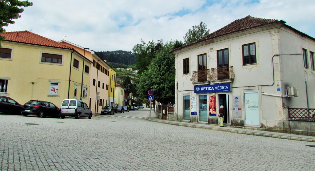
RIBEIRA DE PENA
GPS: N 41.52034; W 7.79307
It is the seat of a municipality with an area of 217.46 km² and 6 544 inhabitants (2011), subdivided into 5 parishes. The municipality is limited to the north by the municipality of Boticas, to the east by Vila Pouca de Aguiar, to the south by Vila Real, to the southwest by Mondim de Basto and to the west by Cabeceiras de Basto.
In 1841, he moved to Ribeira de Pena, Camilo Castelo Branco, where he obtained a place as a notary clerk and where he spent some years of his adolescence. Here he studied Latin, instead of Granja Velha. In 1841 he married Joaquina Pereira de França, a young woman of just 15 years old, in the church of Salvador. From this marriage, in 1843, a daughter, Rosa Pereira de França Botelho Castelo Branco, was born, who would die on March 10, 1848.
PONTE DE ARAME
Ponte de Arame - over the River Tâmega connects the parishes of Ribeira de Pena and Santo Aleixo d’Além Tâmega. It is a construction of the 20th century, dating from 1913, and was due to the need for a connection between the two banks throughout the winter when the flow of the Tâmega covers the various fillies and dams and makes crossing by dangerous boat. When this bridge was built, there was only a jetty between Balteiro and Viela, the Ponderado, that was easily submerged, preventing the connection between the inhabitants of the two banks.


NOVA PONTE DE ARAME
NEW WIRE BRIDGE
It once served as an important connection to two banks, but the filling of the Daivões dam forced this emblematic bridge, built at the beginning of the 20th century, in wire and wood, to change its location.
When it was ordered to be built by the local priest, Albino Afonso, and completed in 1913, serving as a connection to the two banks of the Tâmega, between the parishes of Salvador and Santo Aleixo de Além-Tâmega, nobody could imagine that one day this emblematic bridge would change its " House". But the construction of the Daivões dam and the consequent rise in water levels, compromised the existence of the structure, which exceeds 20 meters in length and is suspended by more than 100 twisted wire cables. The idea of preserving it immediately came up, changing its location, but keeping it in the region. Currently installed in the town of Santo Aleixo, the wire bridge no longer crosses the river, but preserves most of the original features and from it you can see the reservoir. The granite pillars that rested on both sides were recovered and the original dimensions were maintained: 20 meters long and a wooden walkway 1.5 meters wide. The entire remaining structure was subject to intervention and reinforced with steel, wire and wood.
Despite the change in location, the bridge continues to be part of the Caminho do Abade route, a linear trail, 6.5 km long, which runs along rural paths, sidewalks and sections of asphalt. With an easy degree of difficulty, this route connects the Mother Church of Ribeira de Pena to the Mother Church of Santo Aleixo de Além-Tâmega. crossing the historic wire bridge.
GPS: N 41.53791; W 7.79753


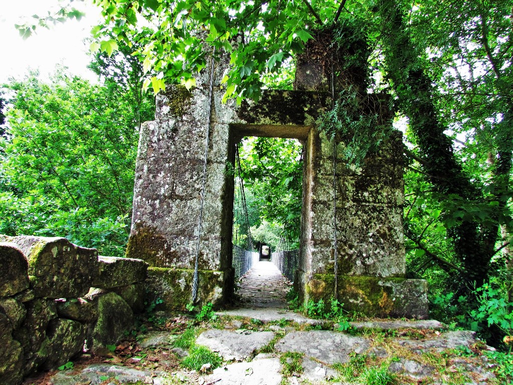


GPS : N 41.54149; W 7.80456


💓💓💓💓💓
SEARCH IN ALPHABETICAL ORDER IN
THE DISTRICT OF VILA REAL.

💓💓💓💓💓
Return to mainland Portugal &
the Azores and Madeira islands

